Windiest States in the U.S. 2026
Mean Wind Power Density at 328 ft (W/m²)
State | Mean Wind Power Density at 328 ft 2025 (W/m²)↓ | Mean Wind Power Density at 328 ft (W/m²) | Mean Wind Speed at 328 ft 2025 (mph) | Mean Wind Speed at 328 ft (mph) | Mean Wind Power Density at 33 ft 2025 (W/m²) | Mean Wind Power Density at 33 ft (W/m²) | Mean Wind Speed at 33 ft 2025 (mph) | Mean Wind Speed at 33 ft (mph) | Average Wind Speed (mph) | |
|---|---|---|---|---|---|---|---|---|---|---|
| Alaska | 1,833 | 1,611 | 10.30 | 21.94 | 1,750 | 1,338 | 9.04 | 16.29 | 16.35 | |
| Wyoming | 1,204 | 964 | 10.39 | 21.48 | 734 | 466 | 7.86 | 14.09 | 20.88 | |
| Montana | 1,057 | 985 | 9.53 | 20.47 | 650 | 552 | 6.98 | 13.51 | 21.03 | |
| Hawaii | 853 | 717 | 9.36 | 19.93 | 435 | 336 | 6.89 | 13.31 | 14.03 | |
| Michigan | 832 | 880 | 9.34 | 20.87 | 405 | 491 | 7.10 | 16.31 | 17.50 | |
| Colorado | 790 | 751 | 9.12 | 19.95 | 472 | 403 | 6.54 | 12.82 | 20.16 | |
| Wisconsin | 759 | 807 | 9.00 | 20.22 | 373 | 446 | 6.88 | 15.66 | 18.40 | |
| Washington | 734 | 686 | 7.91 | 16.98 | 506 | 498 | 5.95 | 11.30 | 15.03 | |
| California | 732 | 649 | 7.81 | 16.64 | 507 | 354 | 6.18 | 10.69 | 13.54 | |
| South Dakota | 663 | 722 | 8.96 | 20.33 | 230 | 247 | 5.76 | 12.82 | 21.32 | |
| Nebraska | 633 | 692 | 9.05 | 20.51 | 217 | 228 | 5.82 | 12.86 | 18.51 | |
| New York | 632 | 705 | 8.31 | 19.10 | 283 | 349 | 6.02 | 13.85 | 15.57 | |
| Oklahoma | 606 | 683 | 8.79 | 20.18 | 178 | 219 | 5.42 | 12.55 | 16.46 | |
| New Hampshire | 600 | 690 | 7.69 | 17.67 | 63 | 197 | 2.68 | 9.06 | 17.13 | |
| North Dakota | 596 | 660 | 8.64 | 19.64 | 208 | 230 | 5.61 | 12.30 | 18.80 | |
| Ohio | 576 | 740 | 8.21 | 19.44 | 260 | 409 | 5.96 | 15.01 | 16.16 | |
| New Mexico | 575 | 560 | 8.59 | 19.17 | 256 | 195 | 5.78 | 11.81 | 17.82 | |
| Utah | 568 | 431 | 7.73 | 15.57 | 451 | 246 | 6.25 | 9.73 | 18.26 | |
| Kansas | 564 | 657 | 8.60 | 19.93 | 170 | 211 | 5.31 | 12.35 | 19.30 | |
| Oregon | 555 | 523 | 7.56 | 16.24 | 315 | 232 | 5.63 | 9.89 | 16.38 | |
| Idaho | 542 | 472 | 7.81 | 16.51 | 440 | 300 | 6.26 | 10.65 | 20.59 | |
| Nevada | 532 | 445 | 7.52 | 15.61 | 424 | 237 | 6.33 | 9.75 | 17.43 | |
| Minnesota | 523 | 592 | 8.24 | 18.90 | 192 | 243 | 5.39 | 12.37 | 18.51 | |
| Texas | 508 | 553 | 8.47 | 19.19 | 163 | 172 | 5.28 | 11.65 | 15.55 | |
| Vermont | 500 | 610 | 7.53 | 17.74 | 95 | 220 | 3.70 | 10.67 | 18.07 | |
| West Virginia | 494 | 583 | 7.29 | 17.02 | 62 | 210 | 2.79 | 9.55 | 18.72 | |
| Maine | 479 | 545 | 7.46 | 17.31 | 88 | 180 | 3.60 | 10.18 | 16.95 | |
| Iowa | 476 | 542 | 8.14 | 18.61 | 133 | 156 | 4.94 | 11.05 | 18.09 | |
| Massachusetts | 473 | 631 | 7.52 | 18.41 | 89 | 241 | 3.55 | 11.72 | 15.76 | |
| Illinois | 467 | 538 | 7.82 | 18.10 | 155 | 204 | 4.96 | 11.59 | 18.28 | |
| Pennsylvania | 454 | 489 | 7.45 | 17.07 | 118 | 134 | 4.04 | 9.37 | 17.42 | |
| Rhode Island | 439 | 572 | 7.43 | 18.05 | 177 | 235 | 5.16 | 11.97 | 14.91 | |
| Maryland | 416 | 556 | 7.23 | 17.74 | 92 | 203 | 3.99 | 11.36 | 19.74 | |
| Arizona | 413 | 355 | 6.92 | 14.45 | 293 | 182 | 5.34 | 8.70 | 15.92 | |
| North Carolina | 407 | 501 | 7.06 | 16.69 | 91 | 195 | 3.90 | 10.13 | 17.99 | |
| Indiana | 405 | 490 | 7.48 | 17.49 | 103 | 147 | 4.37 | 10.45 | 17.84 | |
| Missouri | 390 | 541 | 7.64 | 18.77 | 94 | 163 | 4.37 | 11.32 | 19.31 | |
| Delaware | 369 | 482 | 7.26 | 17.54 | 107 | 196 | 4.40 | 11.54 | 12.91 | |
| Virginia | 343 | 567 | 7.09 | 17.18 | 68 | 211 | 3.32 | 10.33 | 19.32 | |
| New Jersey | 334 | 474 | 6.91 | 17.18 | 86 | 172 | 3.91 | 10.80 | 14.33 | |
| Arkansas | 321 | 421 | 6.94 | 16.69 | 69 | 120 | 3.79 | 9.66 | 16.44 | |
| Tennessee | 313 | 447 | 6.56 | 16.20 | 59 | 158 | 3.34 | 9.55 | 17.43 | |
| Kentucky | 311 | 435 | 6.78 | 16.62 | 73 | 154 | 3.70 | 10.09 | 16.26 | |
| Connecticut | 293 | 394 | 6.51 | 15.86 | 42 | 113 | 2.70 | 8.88 | 13.97 | |
| Louisiana | 286 | 341 | 6.72 | 15.57 | 104 | 157 | 4.60 | 10.89 | 13.60 | |
| District of Columbia | 240 | 247 | 6.06 | 13.56 | 91 | 76 | 3.97 | 7.72 | 31.44 | |
| Mississippi | 240 | 325 | 6.34 | 15.41 | 52 | 94 | 3.44 | 8.97 | 15.19 | |
| Alabama | 205 | 341 | 5.94 | 15.48 | 37 | 105 | 2.87 | 9.08 | 14.70 | |
| Florida | 199 | 245 | 5.99 | 14.09 | 71 | 101 | 4.02 | 9.33 | 14.63 | |
| South Carolina | 197 | 301 | 5.94 | 14.88 | 43 | 105 | 3.06 | 9.08 | 15.88 | |
| Georgia | 180 | 293 | 5.66 | 14.50 | 31 | 93 | 2.79 | 8.46 | 15.34 |
- Mean wind speed and wind power densities were calculated by Global Wind Atlas using data from the top 10 windiest locations measured in each state.
- Wind power density is measured in watts per square meter (W/m�), a unit of measurement commonly used to indicate the energy flux, also described as the amount of power received or emitted by a surface area of one square meter.
- Average wind speed data were calculated by usa.com using data from the U.S. Census American Community Survey.
Wind is defined as the flow of gases on a large scale or, on the surface of Earth, consists of the bulk movement of air. Wind applies to any air in motion, in whatever direction, and at whatever speed.
The wind is caused by differences in atmospheric pressure. When this difference exists, air moves from the area of higher pressure to the area of lower pressure. The differences in air pressure are caused by temperature. Due to the Coriolis effect, air will not flow directly from high to low but will instead be deflected. This is except for exactly at the Equator.
In meteorology, winds are often referred to according to their strength and the direction from which the wind is blowing. For example, winds moving 10 MPH NNW is coming from the north-northwest. Short bursts of high-speed wind are called gusts and strong winds of intermediate duration are called squalls. Winds occur on a range of scales, ranging from local winds caused by uneven heating of land surfaces to global winds resulting from the difference in solar energy absorption between the Earth’s climate zones.
Given this information, some parts of the United States are significantly more windy than other parts. One of the reasons Chicago is known as the “windy city” is because of the frigid breezes that blow over Lake Michigan and through the city streets. The Great Lakes create lake breezes, which are generated mostly on sunny days, causing a large temperature difference between the water and land. States in this region will experience cool lake breezes, especially in the summer.
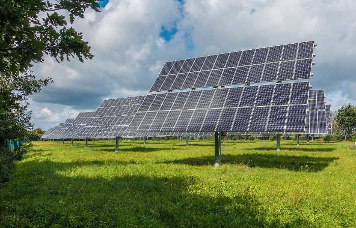
Wind can be used as a renewable energy source. Wind power is generated by wind turbines. When the wind blows against a wind turbine, it turns its blades. The wind turns the blades of a turbine around a rotor that spins a generator either directly or through a shaft and a series of gears that speed up the rotation from the blades and allows for a smaller generator to be used. This creates electricity. In 2019, the United States produced 105,446 megawatts of cumulative wind capacity.
What Determines a Windiest State?
To determine which states are the windiest in America, it is easiest to compare the average wind speeds in each state. Wind speeds in this article are reported in miles per hour (mph).
In general, the windiest states are in the West and the Great Plains, while the Southeast states are the least windy. On the other hand, the ten least windy states in the U.S. are Florida, Arizona, Georgia, South Carolina, Mississippi, Alabama, Louisiana, Utah, Nevada, and Connecticut. The ten windiest states in the U.S. are below.