Most Mountainous States
The highest point in each state in feet
State | Location↓ | The highest point in each state in feet | |
|---|---|---|---|
| Mississippi | Woodall Mountain | 806 | |
| North Dakota | White Butte | 3,506 | |
| New Mexico | Wheeler Peak | 13,161 | |
| Wisconsin | Timms Hill | 1,951 | |
| Missouri | Taum Sauk Mountain | 1,772 | |
| West Virginia | Spruce Knob | 4,863 | |
| South Carolina | Sassafras Mountain | 3,554 | |
| Hawaii | Pu'u Wekiu, Mauna Kea | 13,803 | |
| Nebraska | Panorama Point | 5,429 | |
| Connecticut | Mt. Frissell | 2,379 | |
| Colorado | Mt. Elbert | 14,440 | |
| California | Mount Whitney | 14,494 | |
| New Hampshire | Mount Washington | 6,288 | |
| Kansas | Mount Sunflower | 4,039 | |
| Virginia | Mount Rogers | 5,729 | |
| Washington | Mount Rainier | 14,411 | |
| North Carolina | Mount Mitchel | 6,684 | |
| New York | Mount Marcy | 5,344 | |
| Vermont | Mount Mansfield | 4,395 | |
| Maine | Mount Katahdin | 5,268 | |
| Oregon | Mount Hood | 11,249 | |
| Massachusetts | Mount Greylock | 3,491 | |
| Pennsylvania | Mount Davis | 3,213 | |
| Alabama | Mount Cheaha | 2,413 | |
| Michigan | Mount Arvon | 1,979 | |
| Arkansas | Magazine Mountain | 2,753 | |
| Utah | Kings Peak | 13,528 | |
| Rhode Island | Jerimoth Hill | 811 | |
| Arizona | Humphreys Peak | 12,637 | |
| Maryland | Hoye-Crest | 3,360 | |
| Indiana | Hoosier Hill | 1,257 | |
| New Jersey | High Point | 1,803 | |
| Iowa | Hawkeye Point | 1,670 | |
| Texas | Guadalupe Peak | 8,751 | |
| Montana | Granite Peak | 12,807 | |
| Wyoming | Gannett Peak | 13,804 | |
| District of Columbia | Fort Reno Park | 409 | |
| Delaware | Ebright Road | 447 | |
| Minnesota | Eagle Mountain | 2,301 | |
| Louisiana | Driskill Mountain | 535 | |
| Alaska | Denali | 20,310 | |
| Tennessee | Clingmans Dome | 6,643 | |
| Illinois | Charles Mound | 1,235 | |
| Ohio | Campbell Hill | 1,549 | |
| Florida | Britton Hill | 345 | |
| Georgia | Brasstown Bald | 4,784 | |
| Nevada | Boundary Peak | 13,140 | |
| Idaho | Borah Peak | 12,662 | |
| Kentucky | Black Mountain | 4,145 | |
| Oklahoma | Black Mesa | 4,973 | |
| South Dakota | Black Elk Peak | 7,244 | |
| United States | 6,050 |
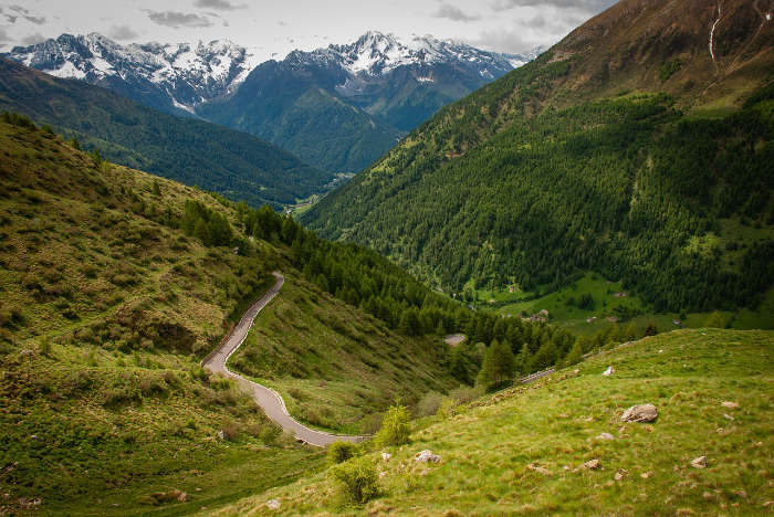
Mountains are massive landforms that rise about the surrounding land with steep slopes and a summit point (peak).
Some of the world’s great mountain ranges include the following. The Himalayas: The Himalayas are 1,491 miles long, running through central Asia from Afghanistan to Pakistan. The Himalayas are home to the tallest mountain globally, Mt. Everest, whose peak is 29,029 feet. The Andes: The Andes stretch over 4,300 miles through South America, making it the world’s longest mountain range. Mt. Aconcagua is the tallest mountain in the Andes, reaching 22,841 feet at its peak. The Alps: Located in central Europe, the Alps are known for their skiing and winter sports. The tallest mountain in the Alps is Mont Blanc, located on the French-Italian border, which sits at 15,782 feet.
The great mountain ranges of the United States are the following. The Rockies: The Rocky Mountains are primarily located in the western United States, stretching from Canada to New Mexico. The Rockies’ highest summit is Mount Elbert, which sits at 14,440 feet in Colorado. Sierra Nevada: The Sierra Nevada Mountain Range runs parallel to the Rockies to its west. The Sierra Nevadas are home to the tallest mountain in the contiguous U.S.: Mt. Whitney at 14,505 feet. The Appalachians: The Appalachian Mountains are located in the eastern U.S. and run parallel to the Atlantic Ocean.
How Mountains are Formed
Mountains are formed through tectonic forces when two of Earth’s tectonic plates collide. The result of this action is slabs of rock being pushed up into the air forming mountains. Some mountains are also formed through volcanic activity. When one tectonic plate is pushed below another, magma below the Earth’s crust is pushed to the surface. Magma below the surface can also be pushed up by volcanic activity below Earth’s crust. When magma reaches the surface, it cools and forms hard rock, resulting in dome mountains. Lastly, mountains are also formed by erosion, although the process is extremely slow. On plateaus, rivers and streams can wear away stone and create deep channels. After millions of years, mountains are carved out with river valleys. The most mountainous states in the U.S. are, unsurprisingly, called the Mountain States. There are eight mountain states, all of which are located in the Mountain Time Zone, except for Nevada.
Colorado
Colorado has the highest mean elevation of any U.S. state at 6,800 feet (2,070 meters). Colorado is known for its ski resorts and many peaks above 14,000 feet. The state is also home to 30 of the Rockies’ tallest peaks, including the 14,440-foot high Mt. Elbert. Colorado’s lowest point is at the Arikaree River at the Kansas border, which is still 3,317 feet (1,011 meters) above sea level.
Wyoming
Wyoming has the second-highest average elevation at 6,700 feet (2,040 meters). The Rockies covers most of Wyoming’s western part. Wyoming’s highest point is Gannett Peak, which sits at 13,804 feet. The lowest point of elevation is 3,125 feet (952 meters) at Bella Fourche.
Utah
Colorado’s neighbor Utah has the third-highest mean elevation in the country. Utah’s mean elevation is 6,100 feet (1,860 meters). Utah is also known for its skiing and winter sports, as well as other landscapes like its famous salt flats. The highest point in Utah is Kings Peak, at 13,528 feet, while its lowest point in Utah is at the Beaver Dam Wash at 2,180 feet.
New Mexico
New Mexico receives the bottom part of the Rocky Mountains. Its average elevation is 5,700 feet (1,740 meters). The state’s landscape includes snow-covered mountain peaks as well as deserts and mesas. New Mexico’s highest peak is Wheeler Peak, sitting at an elevation of 13,161 feet, while its lowest point of elevation is 2,844 at Red Bluff Reservoir.
Nevada
Nevada might come as a surprise to some people because they usually associate the state with deserts. However, Nevada is one of the most mountainous states in the U.S., with an average election of 5,500 feet (1,680 meters). Nevada’s highest peak is Boundary Peak sitting at 13,147 feet. Nevada’s lowest elevation is found at its southernmost border with California along the Colorado River, sitting at 481 feet.
Idaho
Idaho’s average elevation is 5,000 feet (1,520 meters), with its highest peak located at Borah Peak at 12,668 feet. The state is home to several sub-ranges of the Rocky Mountains and, along with Montana, helps connect the Rockies to Canada. Idaho’s lowest elevation is located at the state’s western border at the Snake River, with an elevation of 713 feet.
Arizona
Because Arizona is often associated with deserts, it might also be a surprise to know it’s one of the most mountainous states in the U.S. Arizona’s highest point is Humphreys Peak at 12,637 feet. The state’s average elevation is 4,100 feet (1,250 meters). Flagstaff has an elevation of 6,910 feet, making it the highest city in the state. Arizona’s lowest elevation is the Colorado River at 70 feet.
Montana
Montana is the final Mountain state and boasts the eighth-highest average elevation in the United States at 3,400 feet (1,040 meters). The Rockies run through Montana and Idaho to Canada. Montana’s tallest point is Granite Peak, at 12,807 feet, and the lowest point is 1,804 feet above sea level.
The table below has each state’s highest peak, lowest point, and average elevation. If the lowest point is zero, that means the state’s lowest point is at sea level.