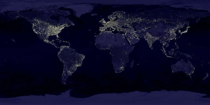
United States by Density 2026
Area (mi²)
State | Area (mi²)↓ | Density | Population | |
|---|---|---|---|---|
| Alaska | 665,384 | 1.3 | 747,379 | |
| Texas | 268,596 | 124 | 32,416,700 | |
| California | 163,696 | 256 | 39,896,400 | |
| Montana | 147,040 | 7.9 | 1,149,100 | |
| New Mexico | 121,590 | 18 | 2,148,440 | |
| Arizona | 113,990 | 69 | 7,801,100 | |
| Nevada | 110,572 | 31 | 3,373,680 | |
| Colorado | 104,094 | 59 | 6,069,800 | |
| Oregon | 98,379 | 45 | 4,309,810 | |
| Wyoming | 97,813 | 6.1 | 592,720 | |
| Michigan | 96,714 | 181 | 10,254,700 | |
| Minnesota | 86,936 | 74 | 5,873,360 | |
| Utah | 84,897 | 44 | 3,624,400 | |
| Idaho | 83,569 | 25 | 2,062,610 | |
| Kansas | 82,278 | 37 | 3,008,820 | |
| Nebraska | 77,348 | 27 | 2,040,670 | |
| South Dakota | 77,116 | 12 | 937,397 | |
| Washington | 71,298 | 123 | 8,159,900 | |
| North Dakota | 70,698 | 12 | 811,610 | |
| Oklahoma | 69,899 | 61 | 4,158,420 | |
| Missouri | 69,707 | 92 | 6,320,320 | |
| Florida | 65,758 | 453 | 24,306,900 | |
| Wisconsin | 65,496 | 111 | 6,022,120 | |
| Georgia | 59,425 | 198 | 11,413,800 | |
| Illinois | 57,914 | 231 | 12,846,000 | |
| Iowa | 56,273 | 59 | 3,287,640 | |
| New York | 54,555 | 427 | 20,127,000 | |
| North Carolina | 53,819 | 234 | 11,375,700 | |
| Arkansas | 53,179 | 60 | 3,126,140 | |
| Alabama | 52,420 | 103 | 5,237,750 | |
| Louisiana | 52,378 | 107 | 4,617,080 | |
| Mississippi | 48,432 | 63 | 2,942,790 | |
| Pennsylvania | 46,054 | 295 | 13,200,800 | |
| Ohio | 44,826 | 294 | 12,001,800 | |
| Virginia | 42,775 | 227 | 8,964,220 | |
| Tennessee | 42,144 | 179 | 7,386,640 | |
| Kentucky | 40,408 | 118 | 4,663,930 | |
| Indiana | 36,420 | 196 | 7,012,560 | |
| Maine | 35,380 | 46 | 1,415,740 | |
| South Carolina | 32,020 | 188 | 5,660,830 | |
| West Virginia | 24,230 | 74 | 1,768,950 | |
| Maryland | 12,406 | 655 | 6,355,540 | |
| Hawaii | 10,932 | 227 | 1,455,660 | |
| Massachusetts | 10,554 | 933 | 7,275,380 | |
| Vermont | 9,616 | 70 | 648,063 | |
| New Hampshire | 9,349 | 159 | 1,422,700 | |
| New Jersey | 8,723 | 1,325 | 9,743,270 | |
| Connecticut | 5,543 | 772 | 3,739,160 | |
| Delaware | 2,489 | 556 | 1,082,900 | |
| Rhode Island | 1,545 | 1,093 | 1,130,070 | |
| District of Columbia | 12,002 | 732,102 | ||
| United States | 3,796,677 |
Population density is the number of human inhabitants per unit of area, typically square mile (mi² or mile²) or square kilometer (km²).
High population densities have their advantages and disadvantages. High population density has enabled economic and social development. However, it can lead to skyrocketing housing costs, more traffic, higher pollution, and additional stress on natural resources such as fresh water. Conversely, areas with low population density may have little economic development, political, economic, and technological isolation, and little or no access to regular human interaction.
The United States has a population density of 93.29 people per mile². The individual states have a wide range of population densities, from 1.28 people per mile² to 11,685.51 people per mile².
What are the least-densely-populated states in the U.S.?
Top 10 States with the Lowest Population Densities (people per square mile)
For those who enjoy wide-open spaces, the United States offers plenty of options. The large states of Alaska, Wyoming, and Wisconsin have the lowest population densities in the country, with Montana having 7 people per mile² in a population of 1,085,000, Wyoming 6 people per mile² with a population of just 581,075 (also the lowest population in the country), and Alaska topping them all with only 1.28 people per mile² relative to its population of 724,357 and a total area of 570,641 miles². Alaska is the largest states in the U.S.
Compared to the other states, the District of Columbia covers a tiny area of just 68 miles², yet it has a population of 703,608, which makes it by far the densest state of all at 11,685.61 people per mile². New Jersey follows, with a population density of 1,207.83 people per mile², and Massachusetts with 883.68 people per mile².
Statistics show a range of population densities in the most highly populated states. California has a total population of 39,613,500, and a population density of 252.74 people per mile². Texas has 29.730,300 people, and its population density is about 110 people per mile² (this is due to its land area being 261,232mi²). In comparison, Florida’s population of 21,312,211 has a population density of 405.45 people per mile².
Several states have very populous cities, which look much different than the states as a whole. For example, New York has a total population of 19,300,000 and a population density of 410.32 people per mile². New York City, the most highly populated city in the United States, accounts for over 8.23 million of the state’s population and has a land area of 302.6 miles², giving it a population density of 27,000 people per mile².


